Thinking about moving to Lakewood and wondering how your commute will fit your life? You are not alone. The W Line light rail and a few key driving corridors can shape your day-to-day more than almost any other factor. In this guide, you will learn how to align your home search with transit options, what to consider for first and last mile connections, and how to compare real-world door-to-door times so you can choose with confidence. Let’s dive in.
How commute planning shapes your Lakewood search
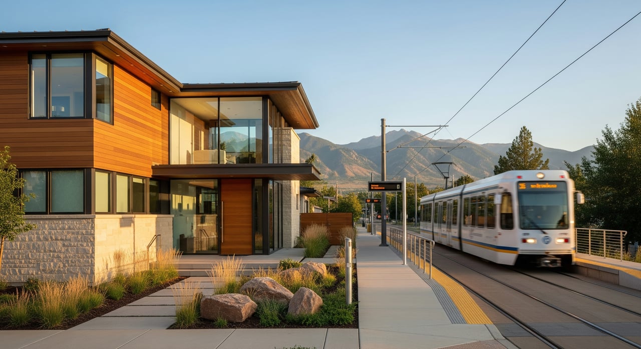
Lakewood gives you multiple ways to reach downtown Denver. The RTD W Line light rail connects Lakewood to Union Station and to central Denver’s light-rail network. Several major roads also funnel drivers east toward downtown, so you can mix and match modes based on your routine.
When you combine commute options with your housing needs, clear patterns emerge. If you want daily rail access, living within a short walk or bike ride of a station can be a priority. If you prefer to drive most days, quick access to the right corridor matters more than proximity to tracks. The key is to plan for your day-to-day, not just a map line.
The W Line: what to know
The W Line is the West Corridor of RTD’s light rail system, linking Lakewood to Union Station and connecting lines downtown. RTD local bus routes provide transfers for neighborhoods that are not within an easy walk of a station. Before you decide on a commute strategy, confirm current station names and locations, weekday and weekend frequencies, and any rider alerts or planned construction.
Walkable-to-rail distances
Buyers often use simple distance bands to set search boundaries around stations:
- Within 0.25 mile: Very walkable for most people. Often the easiest daily rail routine.
- Within 0.5 mile: Comfortable walk for many. Biking or a short bus ride can make this even easier.
- 0.5 to 1.0 mile: Bike, bus, or drop-off range. Good for hybrid commuters who split modes.
Match your distance band to your lifestyle. If you plan to ride rail daily year-round, prioritize the smaller bands. If you ride a few days a week, a slightly longer walk or bike connection may be a fine tradeoff for more housing options.
Station area patterns in Lakewood
As you look at neighborhoods around the W Line, you will see a few common patterns:
- Park-and-ride stations along the West Colfax corridor: Convenient for drivers who want to park, then ride. These areas can have larger parking lots, bus connections, and straightforward bike access.
- Mixed-use centers with retail and services: Near Lakewood’s commercial hubs, you may find housing close to shops, restaurants, and day-to-day errands. This can feel like city-lite living without being in the core.
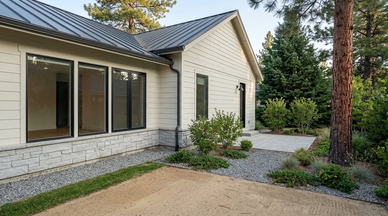
- Established single-family areas just beyond walking distance: A short drive or bus ride to a station can open larger lots and quieter streets, while still giving you transit options when you want them.
Each area type has tradeoffs. Very close to the tracks you may notice train noise or station lighting at night. A few blocks farther out, you might gain quiet but add a bike or bus connection.
Driving corridors to downtown
If you plan to drive some or all days, understand Lakewood’s key routes:
- 6th Avenue / US-6: A primary east-west freeway toward central Denver with direct access to downtown.
- West Colfax Avenue / US-40: A parallel corridor with many local destinations and multiple bus routes.
- Wadsworth Boulevard / CO-121: A major north-south connector that links to I-70 and commercial areas.
- I-70: Useful for certain eastbound commutes from northern Lakewood, depending on your origin.
- Alameda Avenue and Sheridan Boulevard: Common cross-town connectors that feed multiple corridors.
Traffic conditions change by season, events, and time of day. If driving is your main mode, test your specific route during your typical commute times. Compare that with a park-and-ride plus rail alternative so you understand your backup plan.
First and last mile tips
A smooth commute relies on how you start and end the trip. Check these details before you focus your search:
- Walking and biking: Confirm sidewalk continuity, street crossings, bike lanes, and bike parking at your station.
- Feeder buses: Identify which RTD bus routes serve your nearest station and the frequency you can expect during peak and off-peak periods.
- Park-and-ride: Review lot capacity, any permit rules, and typical weekday fill patterns. If a lot fills early, plan a backup station or earlier arrival.
- Drop-off zones and ride-hail: See where short-term drop-offs are allowed and how easy it is to access the platform.
- Accessibility: If anyone in your household has mobility needs, verify ADA features like elevators, ramps, tactile surfaces, and vehicle boarding.
- Street parking near stations: Some blocks may have permit zones or commuter spillover. Ask about posted restrictions before you buy.
How transit access affects pricing and lifestyle
Transit can influence value in several ways. In many markets, homes near frequent rail carry a premium because daily convenience is hard to replicate. Immediate adjacency to tracks or a busy corridor can be a drawback for some buyers who prioritize quiet and nighttime darkness. Balance those factors against your lifestyle goals.
Housing types also shift by proximity. You will often see more multifamily or mixed-use homes closer to stations, and more single-family homes as you move a bit farther away. Walkability and nearby amenities tend to improve as you get closer to stations and major corridors, which can be attractive if you want a vibrant, low-errand lifestyle.
For resale, transit access can widen your future buyer pool. Investors and renters often value reliable access to jobs. On the other hand, areas with limited on-street parking could be less appealing to buyers who rely on multiple vehicles. Think about who might buy from you later.
Make an apples-to-apples comparison
To compare rail and driving fairly, focus on door-to-door time and reliability, not just the time sitting on a train or in a car. Use this simple approach:
- Pick your likely station and your likely driving route to downtown. Include parking location near your workplace if you would drive.
- Test both commutes at the same time of day. Do one AM peak run and one PM peak run for each mode. Note train frequency, transfer needs, and platform wait time.
- Add first and last mile time. Include your walk or bike to the station and the last half mile from Union Station or your downtown stop to your workplace.
- Account for parking. Count the minutes to park at the station and at your office garage, including elevator time and payment.
- Evaluate reliability. Consider how each mode performs in bad weather and during events. Build in a buffer for days when timing is tight.
- Check employer benefits. If your employer offers transit passes or parking allowances, factor that into cost and convenience.
Write down your results for each option. A side-by-side view will make your tradeoffs clear.
Shortlists by commuter type
Here are common buyer profiles and how to focus your search:
Transit-first professional
- Target homes within 0.5 mile of a W Line station.
- Choose areas with daily needs nearby to reduce errand time.
- Visit potential homes at different times of day to gauge train noise and night lighting.
- If you bike, look for protected lanes or quieter parallel streets.
Car owner seeking transit options
- Prioritize quick access to a park-and-ride and a major corridor like US-6 or Wadsworth Boulevard.
- Confirm driveway or garage capacity for your vehicles.
- Map a bus fallback in case you miss a train or the lot is full.
- Think about winter driving routes and snow removal on your block.
Hybrid remote worker
A 0.5 to 1.0 mile station radius can balance quiet streets with occasional rail trips.
Look for a strong home office setup and reliable internet.
Check neighborhood parking rules for guests or a second vehicle.
If you travel, proximity to corridors that connect to I-70 or downtown can save time.
What to verify before you write an offer
Use this checklist during your inspection and due diligence period:
- Current W Line schedule, headways, and any planned service changes that affect your station.
- Park-and-ride capacity, time limits, and fill patterns on weekdays.
- Street parking rules or permit zones within a few blocks of the station.
- Noise and vibration at the property throughout the day and evening.
- Bus routes and frequency for first and last mile needs.
- Accessibility features from your front door to the platform if needed.
- Any City of Lakewood station-area plans or redevelopment projects that could change traffic, parking, or neighborhood character.
How we help you move with confidence
You deserve a plan that fits your life, not a generic map. Our team builds custom station-to-neighborhood maps with 0.25, 0.5, and 1.0 mile buffers, outlines your park-and-ride options, and helps you test commutes at real-world times. We pair that with on-the-ground housing intel so you understand tradeoffs like parking, noise, and future redevelopment before you make an offer.
If you are selling, we position transit access and corridor convenience the right way to reach the widest buyer pool. If you are buying, we negotiate timing and contingencies around your commute needs, so you do not have to compromise on daily life.
Ready to align your Lakewood home search with a smarter commute? Reach out to the Freadhoff Home Group to get a custom plan and local guidance.
FAQs
Which Lakewood areas work best if I want to ride the W Line daily?
- Focus your search within 0.5 mile of a W Line station, or add a reliable bike or bus connection if you are up to 1.0 mile out. Look for mixed-use areas near commercial centers if you prefer walkable errands, and confirm station access features that match your routine.
How long does it take to get from Lakewood to downtown by rail vs driving?
- It varies by origin, time of day, and last-mile needs. Compare door-to-door times for one AM and one PM peak trip for each mode, including walking, waiting, transfers, and parking. Use live map snapshots for driving and the current RTD schedule for rail.
Can I count on parking at my nearest park-and-ride?
- Capacity and fill patterns differ by station and season. Check posted rules, confirm whether lots fill early on weekdays, and keep a backup plan, such as a secondary station, a feeder bus, or an earlier departure.
Are homes near light rail more expensive in Lakewood?
- Many markets show premiums near frequent transit, but the exact impact varies by distance, housing type, and proximity to tracks or busy corridors. Compare recent sales near stations to broader Lakewood trends and factor in tradeoffs like noise and parking constraints.
What about noise and lighting if I live near the tracks?
- Visit the property during morning rush, evening rush, and late night to evaluate train sound, platform announcements, and lighting. Simple mitigations like landscaping and window treatments can help, but your personal tolerance should guide the decision.
Are there projects coming that could change commute times?
- Service adjustments and corridor improvements occur over time. Review RTD rider alerts and City or CDOT plans for the corridors you will use, and confirm timing and scope before you finalize your move.